


053FTBEN3 - FORT BENNING3 Voting District, Chattahoochee County, Georgia
About
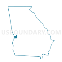
Outline

Summary
| Unique Area Identifier | 560601 |
| Name | 053FTBEN3 - FORT BENNING3 Voting District |
| County | Chattahoochee County |
| State | Georgia |
| Area (square miles) | 7.94 |
| Land Area (square miles) | 7.49 |
| Water Area (square miles) | 0.45 |
| % of Land Area | 94.37 |
| % of Water Area | 5.63 |
| Latitude of the Internal Point | 32.34194620 |
| Longtitude of the Internal Point | -84.98114670 |
Maps


Graphs
Select a template below for downloading or customizing gragh for 053FTBEN3 - FORT BENNING3 Voting District, Chattahoochee County, Georgia


Neighbors
Neighoring Voting District (by Name) Neighboring Voting District on the Map
- 053FTBEN2 - FORT BENNING2 Voting District, Chattahoochee County, GA
- 21540 - KEY ELEMENTARY Voting District, Muscogee County, GA
- 215FTBEN3 - FORT BENNING3 Voting District, Muscogee County, GA
- Spencer Recreation Center-B, Russell County, AL
Top 10 Neighboring County Subdivision (by Population) Neighboring County Subdivision on the Map
- Columbus West CCD, Muscogee County, GA (68,199)
- Phenix City CCD, Russell County, AL (43,357)
- Fort Benning CCD, Chattahoochee County, GA (8,306)
- Fort Benning CCD, Muscogee County, GA (7,881)
Top 10 Neighboring Place (by Population) Neighboring Place on the Map
Top 10 Neighboring Elementary School District (by Population) Neighboring Elementary School District on the Map
Top 10 Neighboring Secondary School District (by Population) Neighboring Secondary School District on the Map
Top 10 Neighboring Unified School District (by Population) Neighboring Unified School District on the Map
Top 10 Neighboring State Legislative District Lower Chamber (by Population) Neighboring State Legislative District Lower Chamber on the Map
- State House District 132, GA (42,799)
- State House District 148, GA (41,718)
- State House District 83, AL (41,039)
Top 10 Neighboring State Legislative District Upper Chamber (by Population) Neighboring State Legislative District Upper Chamber on the Map
Top 10 Neighboring 111th Congressional District (by Population) Neighboring 111th Congressional District on the Map
Top 10 Neighboring Census Tract (by Population) Neighboring Census Tract on the Map
- Census Tract 309.02, Russell County, AL (6,946)
- Census Tract 115, Muscogee County, GA (5,496)
- Census Tract 202.01, Chattahoochee County, GA (4,042)
- Census Tract 202.05, Chattahoochee County, GA (2,919)
- Census Tract 108.01, Muscogee County, GA (1,427)
- Census Tract 202.03, Chattahoochee County, GA (1,141)